
Colorado Trip Preperations
#21
 07-10-2012, 02:51 AM


The Gaz doesn't always distinguish well enough between a major hiking trail vs. a dual-use motorized trail, however.
As far as testing the links it is really easy. You just open Google Earth, and in the Add menu item select the Network Link item and then just paste one of the HTML links in between the parenthesis. I just want to see if it works for others besides myself.
#22
07-10-2012, 02:54 AM
I have copied pages out of my Gazetteer for trail maps. Pretty good maps, and no biggie if you ruin it. My buddy, TNC steered me towards the Latitude 40 maps. I just got my new Colorado front range map in the mail from them last week. Very nice maps. Can't wait to put it to use next week  Latitude 40 Maps
Dan
Latitude 40 MapsDan
#23
07-10-2012, 03:04 AM
Oh...I see where you're headed with that, foos. I will try to plug that in and report. And Dan...the other Dan...those Lat 40 maps are the best for off roading compared to anything out there IMO. They just don't cover everything of importance in CO. I like how they differentiate between the different trails of all kinds. Motorized singletrack is even broken down to those that allow ATVs and those that don't. Excellent maps.
...those Lat 40 maps are the best for off roading compared to anything out there IMO. They just don't cover everything of importance in CO. I like how they differentiate between the different trails of all kinds. Motorized singletrack is even broken down to those that allow ATVs and those that don't. Excellent maps.
#24
07-10-2012, 01:13 PM

Join Date: Dec 2011
Location: Central Indiana
Posts: 229
Landon, what specifically do you need to know? I may know every trail or 2-track you list or know enough about them to steer you right. If you have a question, ask it here. I'd rather keep it in the open post as others might also have insight about your questions, and others might be thinking about a similar trip.
Grand Mesa, Uncompahgre, and Gunnison Trails
Rio Grande Trails
I then took my Forest Service maps and these websites and created a nice list of Trails in the Lake City Area that has the trail name, number, and length on the list.
I still need help locating McKenzie Stock Driveway and Jarosa Mesa that you guys mentioned.
I tried attaching my list but it says the Excel file is invalid.
#25
07-10-2012, 01:38 PM
McKenzie is reached by taking FR532 east off of hwy 149 a few miles south of LC. McKenzie is FT804. That side trip to Bristol Head peak is awesome.
On Jarosa Mesa, at Spring Creek Pass on hwy 149...just south of LC...you take FR547 to the east and go to a short singletrack FT3322 to the north. You can either take FR473 back to hwy 149 or keep going north to hit hwy 149 further up.
Beware looking at some maps that show a trail but don't explain if the trail is motorized or not. It may look like you can keep going to make a connection down some of these trails, but they become hiking trails only. The routes I've explained on these posts were motorized the last I saw them and still show to be on my maps. The forest service will sometimes change things quickly, however.
#26
07-10-2012, 02:11 PM
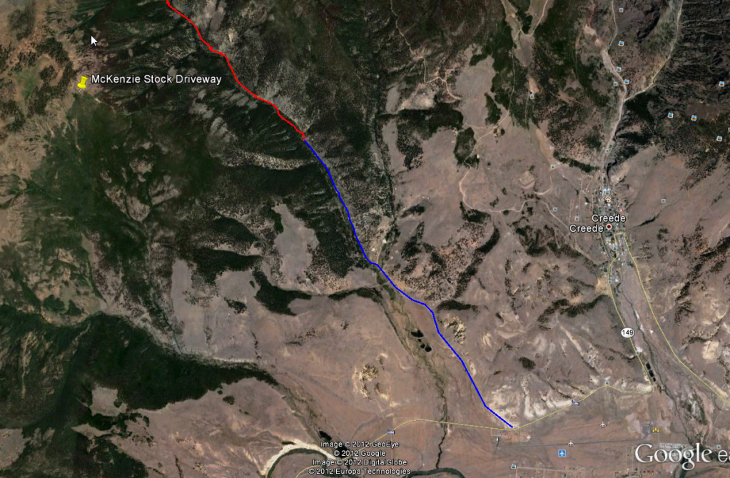
The first image shows the location of the McKenzie Stock Driveway
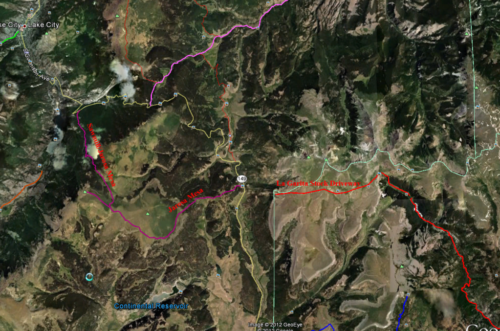
This image shows the Jarosa Mesa and the LaGarita Stock Driveay. I think the part of Jarosa Mesa that is closest to Lake City is a road called Sawmill RD.
Thad are you referring to the Continental Divide Trail and or the Colorado Trail which I believe both go through the area from Lost Creek Trail all the way through the Lagarita Stock Driveway.
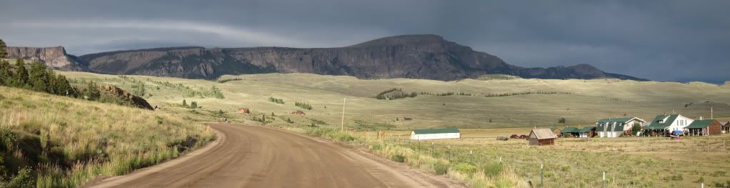
Here is a photo of Bristol Head from Road Canyon.
Dan
This image shows the Jarosa Mesa and the LaGarita Stock Driveay. I think the part of Jarosa Mesa that is closest to Lake City is a road called Sawmill RD.
Beware looking at some maps that show a trail but don't explain if the trail is motorized or not. It may look like you can keep going to make a connection down some of these trails, but they become hiking trails only.
Here is a photo of Bristol Head from Road Canyon.
Dan
#27
07-10-2012, 03:00 PM
Join Date: Dec 2011
Location: Central Indiana
Posts: 229
Is McKenzie an out and back then? Or does it connect by taking FR532 off 149 near LC to McKenzie and come out near Creede?
Is Bristol Head an out and back off McKenzie???
Is Bristol Head an out and back off McKenzie???

#29
07-10-2012, 03:09 PM
Yes, they're both out-and-back. People have different feelings about out-and-back trails, but frankly out in the boondocks like this, these trails usually give you a whole different flavor going both ways. Plus, the forest service has often killed many of the loop aspects of many of these great trails for some reason.
#30
07-10-2012, 03:10 PM
Join Date: Dec 2011
Location: Central Indiana
Posts: 229
Ok, I found it. But can you confirm if its open the dirt bikes?
This link leads me to think its not...
McKenzie Trail 804
This link leads me to think its not...
McKenzie Trail 804