
Camping/ride report--warning 50 + pictures

Thread Starter
|
Your Humble Moderator/Admin
Joined: Nov 2005
Posts: 21,060
From: Washington
1st Gear Member
Ok I guess it was time to get back into the swing of things and get a good ride report posted. However I felt the need to include some scenery pics as well. Kind of taking the old family slide into cyberspace. I hope nobody minds, I'll save the actual Ride report toward the end, so that way you have something to look forward to. Sorry for how many pictures listed here, and I actually only included the real good ones. Ok here goes. If you remember I headed to the shop to pick up the KLX and the TW200 and we got over half way there and I realized I forgot my helmet as I wanted to ride the bike back 35 miles to the lake, so what was I going to do? Oh sure I could have loaded the bike up in the truck and pouted all weekend while it sat there in the Camp ground parking lot, but nooooooooooo I decided to buy a new helmet and some gloves. Well I liked the look of the green Vega MX helmet, and I also really liked the look of the Matte black Scorpion helmet, I decided to get one of these. Kind of like a combination of both.

And here is the Tensioner that they replaced, it still looks good, I wonder if it really is causing the noise, the mechanic said something that I didn't realize. He said that when you add a skid plate, it amplifies noises up, and so sometimes noises were always there, but now the plate is sending it up. Hmmm food for thought I guess. They said that usually they don't give you the parts, because they are required to keep all warranty parts for 90 days, but they told me if they needed it they knew how to get a hold of me.

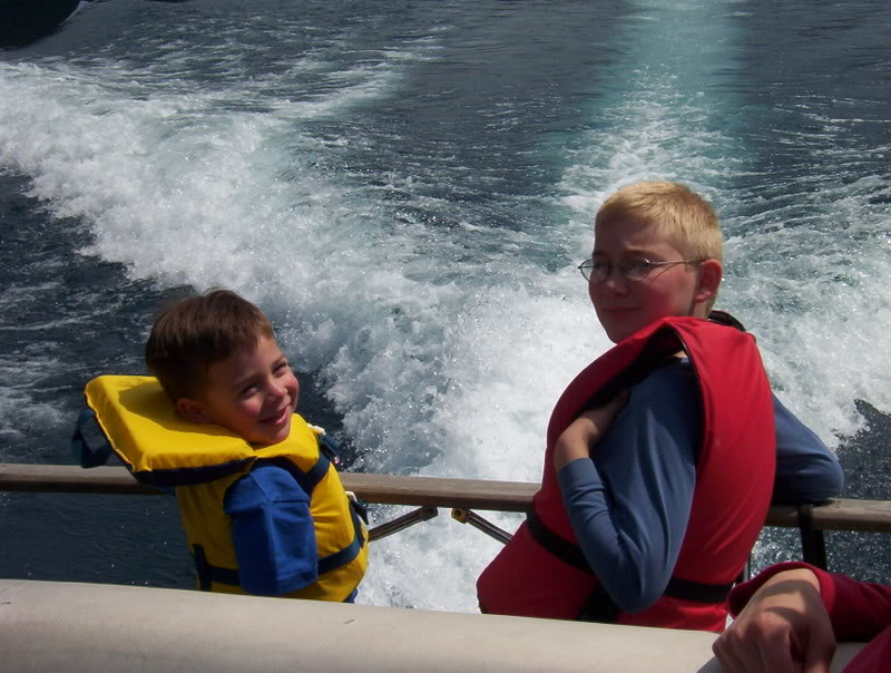
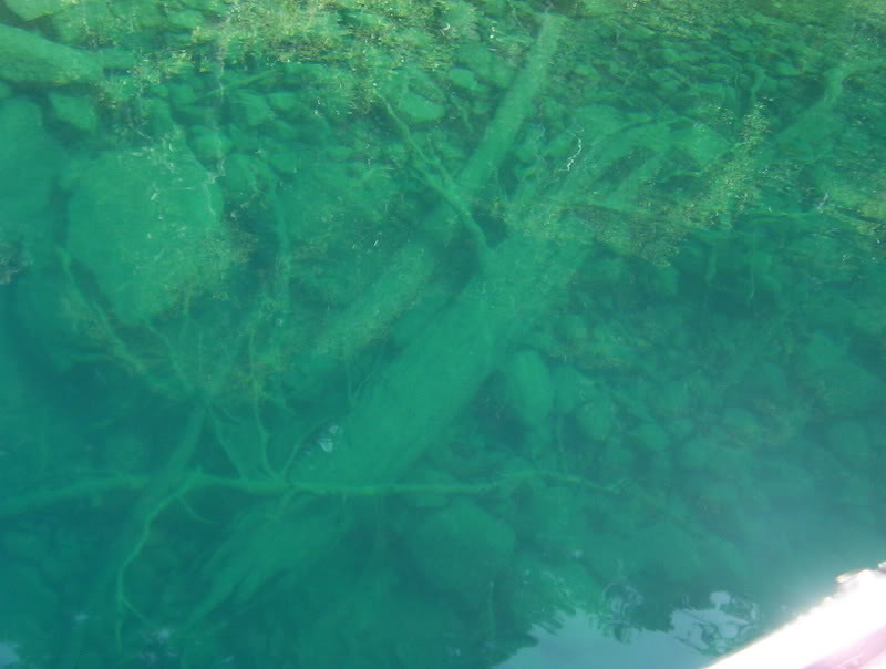
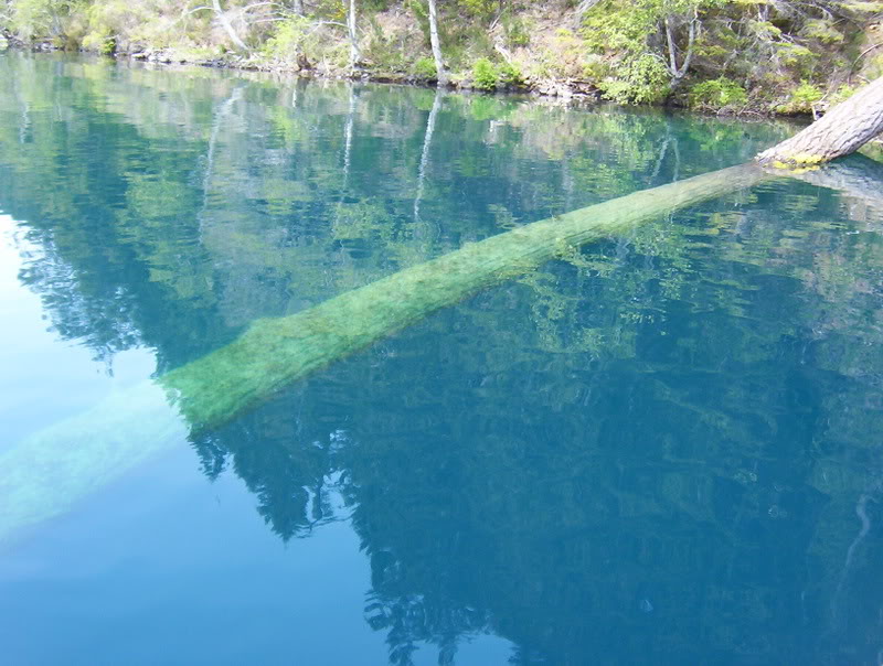
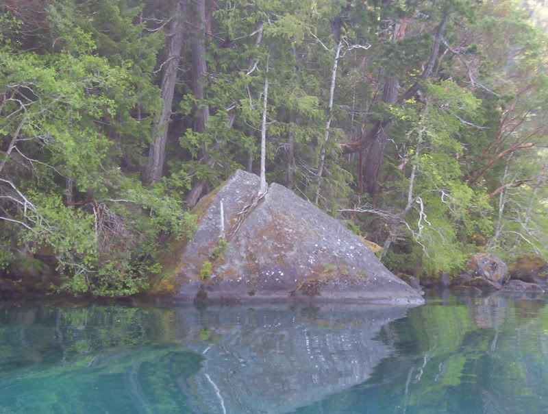
Ok now if you can forgive me for posting some scenery pics, this is the lake we stayed at, its 600 ft deep at the deepest spot, and goes from 1 ft deep to 160 in only 40 ft from shore. Here are a few pics.
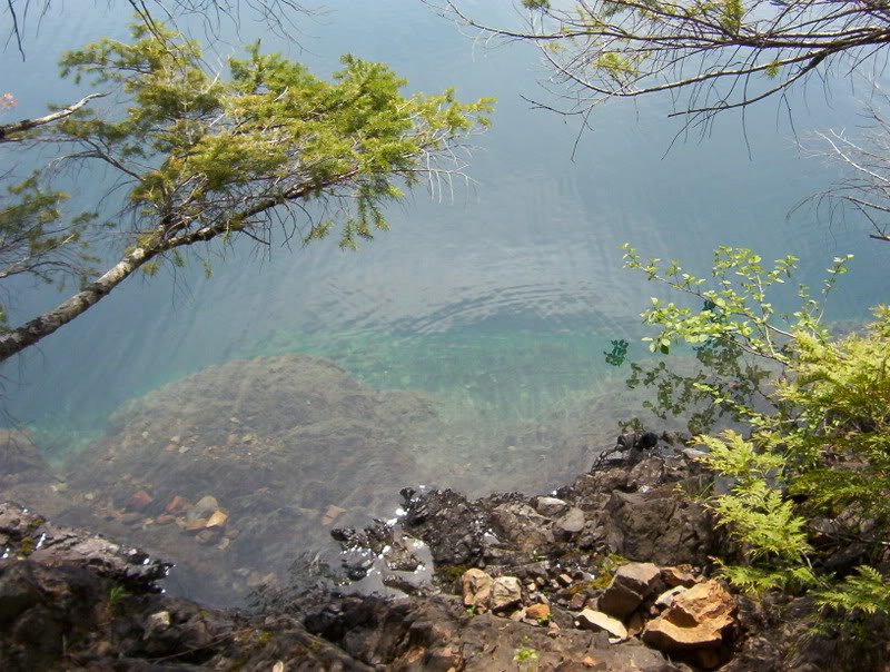
These pictures are 40-60 ft deep

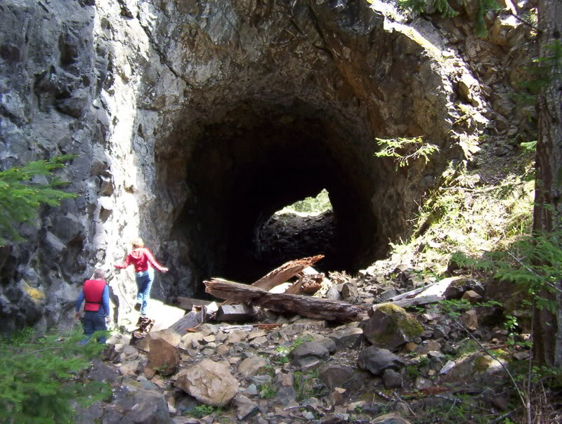
Ok now these next few are from an old train tunnel from the 20's and 30's used to haul out giant spruce logs.

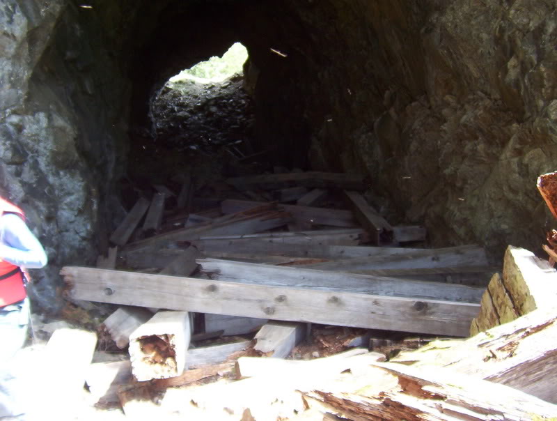
Original timbers used for the tracks
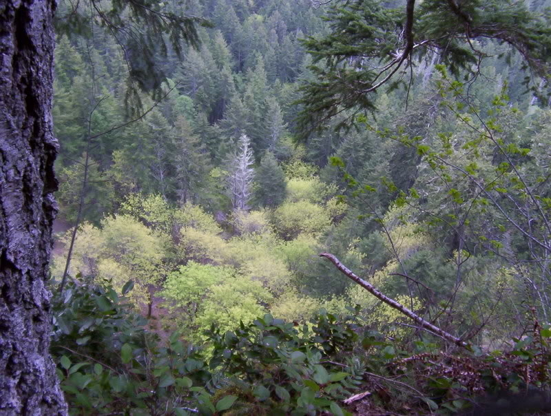
Ok now onto the ride report. About5 miles from the park a friend and I headed up to the power lines, and we got up there and I realized that I had forgot my camera. So these pictures are from the second day when I re-traced the trip. Some of the campers probably didn't appreciate me getting up at 7:30 and heading out, but oh well.
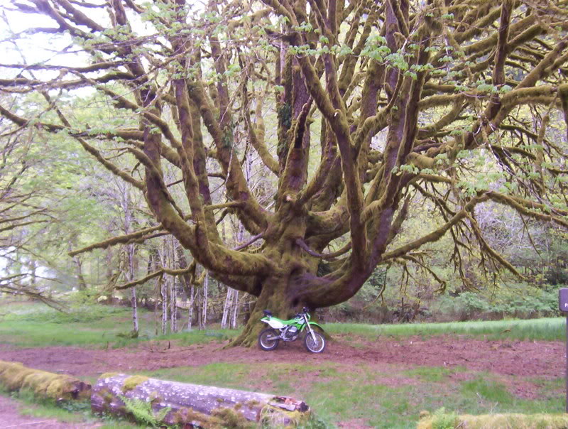
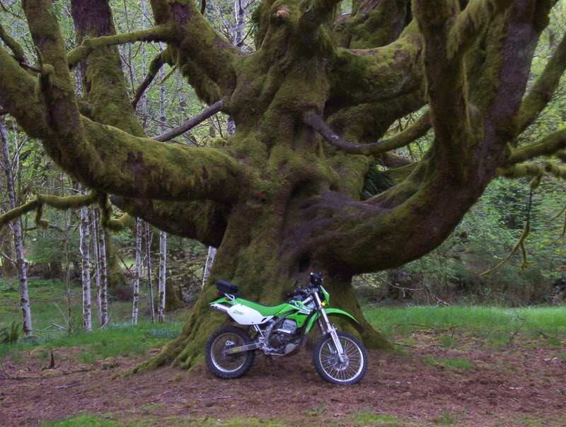
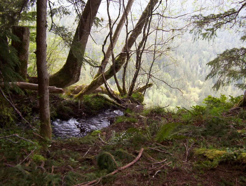
This first one is from the boat launch, I just thought this tree was cool.
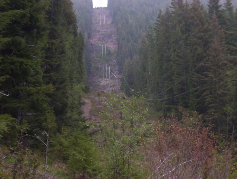
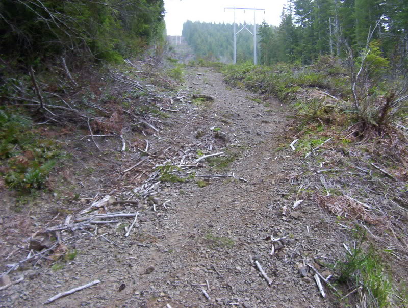
Ok a short trip up the highway and I came back to the bottom of the power lines.

I'm just going to post the pictures as I took them, I figure this is going to be long enough without me going on and on.......Well you didn't have to agree with me.[8D]
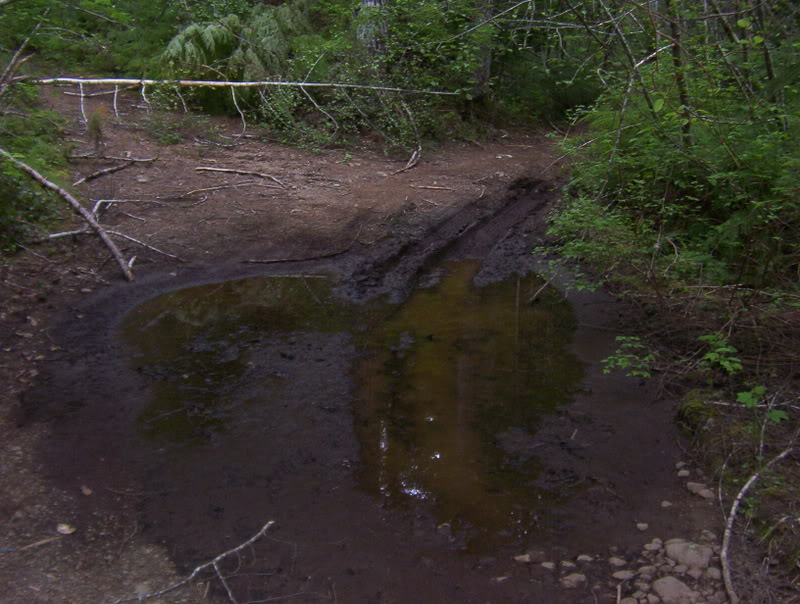
Yes there was a little mud.
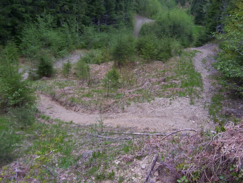
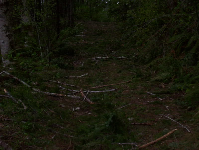
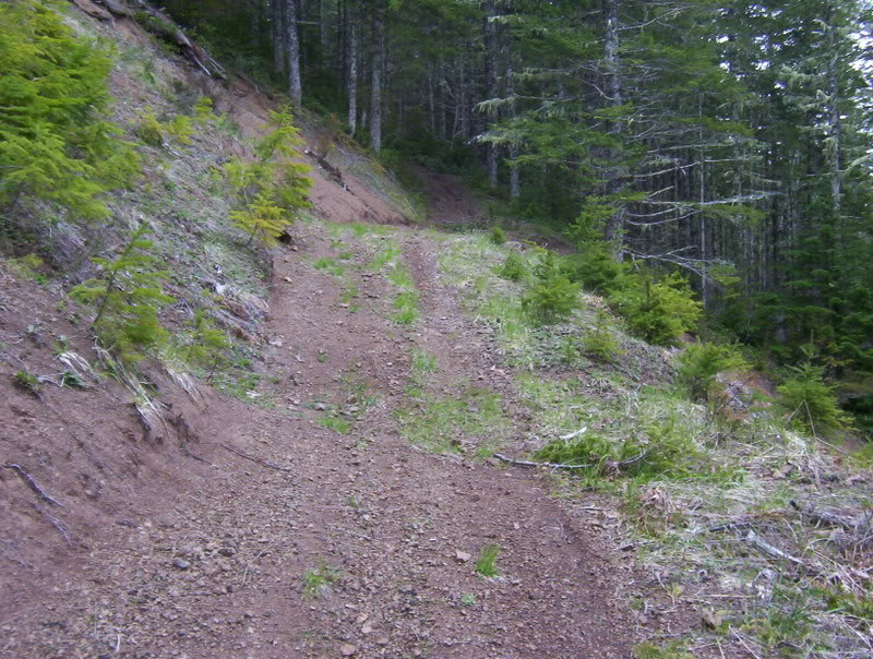
Its all steeper than any of these pictures can do justice.
I didn't actually go up the single track trails, there were switchbacks all the way up, but still quite a work out.

Half way up.
Looking back you can see the highway way down at the bottom. Also that trail is not where you come up, there was a switchback.

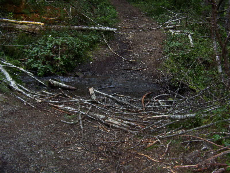
Storm debris
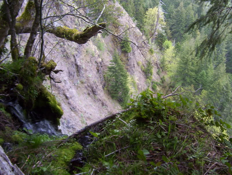
Ok these next few pictures are of a place I visited about 12 years ago, and I have to say if you have ever been close to the edge of somewhere you knew that you shouldn't have been and had the hair on the back of your neck stand straight up, I can guarantee this would do it. The edge doesn't just drop off 3-400 feet, it actually goes under you and then down. I tried to take a few pics, but I got all freaked out and didn't want to get any closer. I didn't want to end up on the news as one more victim hiker falling to a horrible death. Dang I just got one of those all over body shivers thinking about it again.[8D]


Ok back to the ride.

Getting closer to the top
Looking back again.

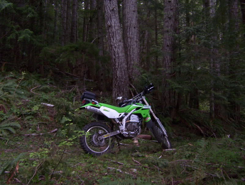
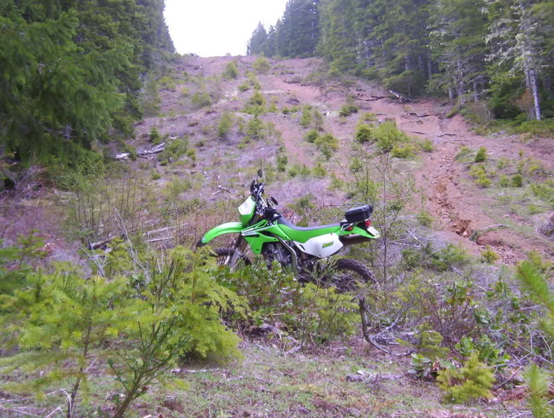
Ok here is where it got interesting real fast, as I came around the corner I found what some of the people that I have talked to call the hard part, and lets just say it was harder than I wanted to try or will try again. I got half way up and thought to myself "deej (yea I call myself deej too) what are you doing you stupid idiot." I quickly realized that there was no way I was going to make it, and since I was by myself I had better find a safe way to end this and get back down this mountain. So I hit the brakes and dumped the clutch and laid the bike down. Now as I said before, pictures never really show how steep a trail is, so imagine it waaaaaaaay steeper.


Ok this picture is looking down from where I set the bike down, and it actually looks accurate, I guess pictures looking up are less accurate, and down they are closer to the real thing.
[IMG]http://i27.ph
And here is the Tensioner that they replaced, it still looks good, I wonder if it really is causing the noise, the mechanic said something that I didn't realize. He said that when you add a skid plate, it amplifies noises up, and so sometimes noises were always there, but now the plate is sending it up. Hmmm food for thought I guess. They said that usually they don't give you the parts, because they are required to keep all warranty parts for 90 days, but they told me if they needed it they knew how to get a hold of me.
Ok now if you can forgive me for posting some scenery pics, this is the lake we stayed at, its 600 ft deep at the deepest spot, and goes from 1 ft deep to 160 in only 40 ft from shore. Here are a few pics.
These pictures are 40-60 ft deep
Ok now these next few are from an old train tunnel from the 20's and 30's used to haul out giant spruce logs.
Original timbers used for the tracks
Ok now onto the ride report. About5 miles from the park a friend and I headed up to the power lines, and we got up there and I realized that I had forgot my camera. So these pictures are from the second day when I re-traced the trip. Some of the campers probably didn't appreciate me getting up at 7:30 and heading out, but oh well.
This first one is from the boat launch, I just thought this tree was cool.
Ok a short trip up the highway and I came back to the bottom of the power lines.
I'm just going to post the pictures as I took them, I figure this is going to be long enough without me going on and on.......Well you didn't have to agree with me.[8D]
Yes there was a little mud.
Its all steeper than any of these pictures can do justice.
I didn't actually go up the single track trails, there were switchbacks all the way up, but still quite a work out.
Half way up.
Looking back you can see the highway way down at the bottom. Also that trail is not where you come up, there was a switchback.
Storm debris
Ok these next few pictures are of a place I visited about 12 years ago, and I have to say if you have ever been close to the edge of somewhere you knew that you shouldn't have been and had the hair on the back of your neck stand straight up, I can guarantee this would do it. The edge doesn't just drop off 3-400 feet, it actually goes under you and then down. I tried to take a few pics, but I got all freaked out and didn't want to get any closer. I didn't want to end up on the news as one more victim hiker falling to a horrible death. Dang I just got one of those all over body shivers thinking about it again.[8D]
Ok back to the ride.
Getting closer to the top
Looking back again.
Ok here is where it got interesting real fast, as I came around the corner I found what some of the people that I have talked to call the hard part, and lets just say it was harder than I wanted to try or will try again. I got half way up and thought to myself "deej (yea I call myself deej too) what are you doing you stupid idiot." I quickly realized that there was no way I was going to make it, and since I was by myself I had better find a safe way to end this and get back down this mountain. So I hit the brakes and dumped the clutch and laid the bike down. Now as I said before, pictures never really show how steep a trail is, so imagine it waaaaaaaay steeper.
Ok this picture is looking down from where I set the bike down, and it actually looks accurate, I guess pictures looking up are less accurate, and down they are closer to the real thing.
[IMG]http://i27.ph
Admin
1st Gear Member
Joined: Jan 2006
Posts: 7,269
Great photos, great report. Those are some really steep trails you were on.
The problem with showing the steepness of inclines with a photo is that most folks point the camera down or up the trail to get as much in view as possible. But that makes the trail look much more level. The best way to show the steepness of the hill is to use another point of reference like a tree. Since they always grow straight vertical, alighn the edge of the camera view finder with the vertical tree then snap. That way, the camera is pointed level. You won't get as much in the photo, but the incline will be much more accurate.
Nice job, though - looks like lots of fun. BTW, I get the ******* too when near a ledge. Must be that survival instinct kicking in.

Senior Member
1st Gear Member
Joined: Jul 2006
Posts: 339
From: Abedeen,Maryland
Great ride report.... and pics and I agree about the skid plate and the noise I took mine off after 5 miles I couldn't stand all the racket..... I sprayed some rubber undercoat on it but have not tried it yet......

Senior Member
1st Gear Member
Joined: Mar 2007
Posts: 684
From: Sellersville,PA.
wow...beautiful ride you went on...mind I ask where it was?????.I have seen some nice places but you definatley ate the cake on that one....kudos to you.

Member
1st Gear Member
Joined: Jun 2006
Posts: 66
From:
Definitely some good photos mixed in there.
What lake by chance was that?, I'm up in Washington now and then from the Salem, OR area. If I ever pass by that lake I might stop by there for a bit to explore some of those areas myself.
What lake by chance was that?, I'm up in Washington now and then from the Salem, OR area. If I ever pass by that lake I might stop by there for a bit to explore some of those areas myself.

Senior Member
1st Gear Member
Joined: Apr 2007
Posts: 227
From: Salem, NJ
that photo of the first tree is awsome. and the trees are friggin huge compared to the ones here in jersey. bet your glad you went and bought that helmet to go riding now that you were there. i prob would have done the same thing.

Senior Member
Joined: Dec 2006
Posts: 410
From: Atlanta, GA USA
Nice report! It make me want to get out there and do some exploring. Looks like you had a great time. Did you do any damage to your bike with the get off?
